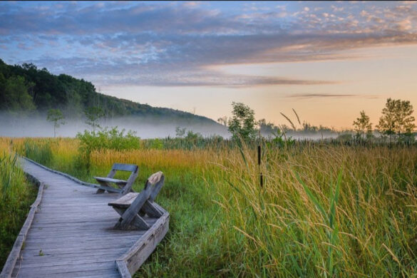
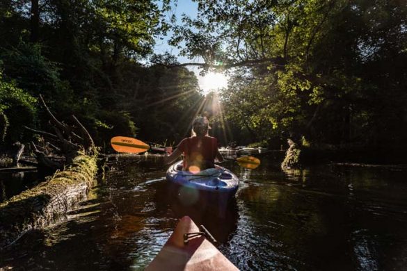
You’ve had a long week and now it’s time to get out into nature. But what to do and where do you go? Hiking, paddling, walking, bicycling, or simply sitting and taking in the views in the Great Swamp Watershed offer excellent opportunities to experience the natural world, exercise, and spend time with family and friends.
There are many miles of trails to hike in conservation areas, parks, preserves, wildlife management areas, and the Appalachian Trail crossing. Some of these are open to mountain biking and in the winter offer exceptional snowshoeing and cross-country skiing sites. The Maybrook Trailway offers a paved trail to walk, run, and bike.
Many of the best places to paddle kayaks or canoes in the Hudson Valley are in the Great Swamp, accessible from 4 launch sites. There are 14 miles of navigable water in the South Flow, and a few miles of seasonally-accessible paddling on the Swamp River in the North Flow.
In addition, there are numerous scenic vistas to simply observe and appreciate the Great Swamp. Here is a list of the major access points based on planned activity, from north to south:
|
Paddling, Hiking, Walking, and Biking Access Points |
|
| Wingdale and Dover | |
| 1 | DEC Launch Site at Wheeler Road: From Route 22, turn west at the traffic light at the Metro-North Railroad Harlem Valley–Wingdale Station. Look for a sign marking the grassy parking lot on the right just past the railroad tracks, and before the gated bridge over the river. This launch site is only viable when there is high water (Spring is best), and it’s better to head south (upstream) first. |
| Pawling | |
| 2 | Pawling Nature Preserve: There are several access points. The Orange Trail entrance is at the intersection of Furlong and Sprague Roads in Wingdale. For Yellow Trail access, from Route 22 turn east onto N. Quaker Hill Road. Make a left on Quaker Lake Road, continue past the lake to the parking lot for the trailhead. Extensive trail system. |
| 3 | Appalachian Trail at The Dover Oak: From Route 22 take Corbin Road west. Make a right on W. Dover Road and continue 2.1 miles to The Dover Oak on the right. Park on the shoulder. |
| 4 | Appalachian Trail at Route 22: Park in the lot at the MetroNorth Appalachian Trail station, just south of Native Landscaping on Route 22. There are also rest stops along both sides of Route 22 just north of the train station with parking and excellent views of the flood-plain and Corbin Hill to the west. |
| 5 | Appalachian Trail at Route 55. There is a small parking lot on the north side of Route 55, approximately 5.2 miles west of Route 22. There is also parking along the shoulder where the Appalachian Trail crosses Old Route 55. |
| 6 | Maybrook Trailway at Old Route 55: Parking lot is just south of the intersection of Route 292 and Old Route 55. |
| Holmes | |
| 7 | Maybrook Trailway at Holmes: Parking lot is 0.1 miles north of Holmes Road at Route 292. |
| Patterson | |
| 8 | Patterson Environmental Park: From Route 311 at the Town Hall, head south on Front Street. Continue until it ends (at Patterson Rec Center), then make a left and drive over the railroad tracks (this is an uncontrolled crossing, STOP and look for approaching trains before crossing) onto the unpaved road. There is a parking lot immediately after crossing the tracks, and parking at the end of the road at the river that is convenient for launching kayaks and canoes. There is also a boardwalk and short trails along the swamp. |
| 9 | Great Hollow Nature Preserve: The Great Hollow Preserve parking lot is 100 yards north of the intersection of Haviland Hollow Road with CT Route 37. Four miles of trails. |
| 10 | Cranberry Mountain Wildlife Management Area: Take Birch Hill Road east from the Thunder Ridge Ski area. When it ends, make a right onto Stagecoach Road and continue 0.6 miles to the parking area. Extensive trail system. Popular hunting area. |
| 11 | Michael Ciaiolo Conservation Area: From Route 22 take Haviland Hollow Road (at Putnam Diner) east. Just before Quaker Brook and Connecticut, make a left into the Ciaiolo parking lot. Extensive trail system. |
| 12 | Great Swamp Wildlife Management Area: Parking lot is on Cornwall Hill Road, 1.5 miles south of Route 311 and 0.9 miles north of Route 164. Mowed paths throughout open fields. Popular hunting area. |
| 13 | Laurel Ledges: From Route 22 head west on Route 164. Go 1.6 miles and make a right turn onto Cornwall Hill Road. The parking pull-off for the Laurel Ledges trail is 0.4 miles on the right at the trailhead sign. |
| 14 | Sterling Farm Preserve: There is a parking lot on Couch Road just south of Cornwall Hill Road (at “Tom’s Path”). Cross to the other side of the road and walk south 100 yards to the trailhead into the Preserve, |
| 15 | Wonder Lake State Park: From Route 311, head north on Ludingtonville Road; parking lot is 1.8 miles on right. From Ludingtonville Road exit off I84, head southeast to parking lot 1.5 miles on left. Extensive trail system. |
| 16 | Maybrook Trailway at Route 311: Parking lot is on the west side of Route 311, 0.4 miles east of Route 164. There is also a parking area on Route 164 at Bullet Hole Road. |
| 17 | Ice Pond Conservation Area: From Route 312, head north on Ice Pond Road. After approximately 2 miles, look for a the trailhead sign on the right where there are a few parking spots. |
| 18 | William Clough Preserve: From Route 312 head north on Farm to Market Road for 0.8 miles. Just past the school complex there is a small parking lot on the left. An 0.5 mile swamp-side trail connects with the Maybrook Trailway at Ice Pond. |
| Brewster and Southeast | |
| 19 | Green Chimneys: Open weekends and holidays only. From Route 22, go 1.9 miles east on Doansburg Road (County Road 65). Green Chimneys school will be on the right, make a left turn into the parking lot for the kayak/canoe launch area and a boardwalk offering wetland views. |
| 20 | Donald B. Smith Conservation Area: From Route 22, go 1.8 miles east on Doansburg Road (County Road 65) and make a sharp right onto Gage Road. Go 0.6 miles and bear right onto Old Doansburg Lane. In 0.3 miles, the road will end in a loop at the launch area. |
| 21 | Bog Brook Unique Area: Take Old Doansburg Road from Route 22, then turn west onto Foggintown Road. Continue 0.5 miles to the parking lot on right. Technically not part of the Great Swamp watershed because its drainage does not flow into the East Branch Croton River. Short trails (<1 mile roundtrip) along the bog with observation platform. |
| 22 | Doansburg Preserve: From Route 22, head east on Doansburg Road. Continue 1.6 miles and turn right at Mill Farm Lane. The preserve is on your left, just before the intersection with Shannon Way. There is a wooden sign facing the road. Park on the side of the road. Short 0.1 mile trail to a birding platform. |
| 23 | Glenda Farrell – Henry Ross Preserve: From Route 22, head east on Milltown Road. Continue 2.2 miles and Preserve will be on the left with limited parking. Two loop trails, 0.6 and 0.8 miles long. |
| 24 | Maybrook Trailway at Castle Park: From Tonetta Lake Road, head north on Pumphouse Road for 0.7 miles to Castle Park where there is parking. |
To download a map showing the main access points, please click here.


